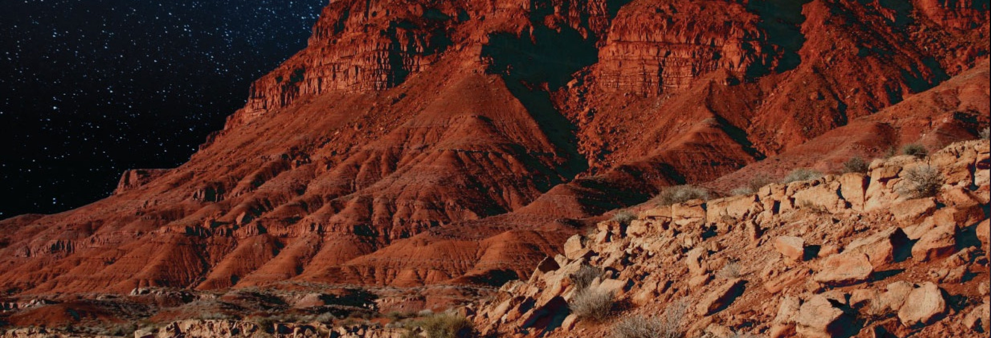
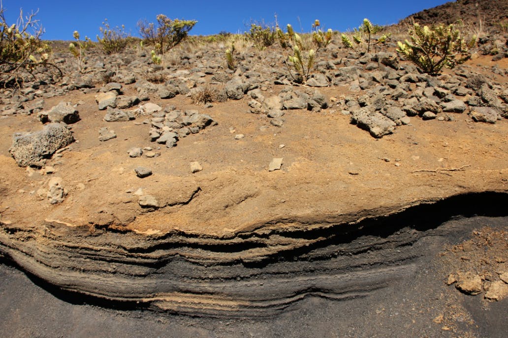
Tephra
About the Tephra Community
Tephra is a unique volcanic product that plays an unparalleled role in understanding past eruptions, long-term behavior of volcanoes, and the effects of volcanism on climate and the environment. Tephra deposits provide spatially widespread, extremely high-resolution time-stratigraphic markers across a range of sedimentary settings and are used in a range of disciplines (e.g. volcanology, seismotectonics, climate science, archaeology, ecology, public health and impact assessment). Nonetheless, the study of tephra deposits has been challenged by the lack of standardization that often prevents comparison amongst various regions and across disciplines.
The global, interdisciplinary tephra community coordinated through the IAVCEI Commission on Tephrochronology has established best-practice recommendations for tephra studies. The recommendations can be found on Zenodo.
About the Tephra Information Portal (TIP)
The Tephra Information Portal (TIP) is an NSF-funded platform designed to enable easy discovery, access, sharing, and archiving of high-quality tephra data, sample details, and metadata. TIP is a collaboration between the global Tephra Community and IEDA2 as part of the development of the Framework for FAIR Data Communities. TIP aims to link distributed geoscience databases, support FAIR data standards, and provide tools for visualization, collaboration, and legacy data rescue.
News & Announcements
Upcoming Events
We have the following presentations and events at EGU (3-8 May) in Vienna! We look forward to seeing you in Austria Center Vienna.
Tephra-related Sessions and Presentations:
Tephra Information Portal Townhall: Thurs 7th May, 19:00-20:00 in Room M1. Find out what TIP is and how it is helping provide researchers with a central hub for discovering, accessing, and sharing data. https://www.egu26.eu/session/59089
SESSION GMPV11.1 “Hazards related to explosive volcanism: tephra dispersal and pyroclastic density currents” Posters Tue 5th May, 08:30–10:15 Hall X2; Oral Tue 5th May, 16:15–18:00 Room 2.2. With invited speaker Mathieu Colombier of Munich University.
SESSION SSP2.7 “Tephra research beyond boundaries: integrative applications and data-driven innovation in Earth system sciences” Posters Mon 4th May 08:30-10:15 Hall X3; Oral Tue 5th May 08:30-10:15 Room 2.93. With invited speakers Matthew Loewen of the Alaska Volcano Observatory and Victoria Smith of the University of Oxford.
- POSTER: EGU26-15261 “The Tephra Information Portal (TIP): A Community-Driven Approach to Facilitating Access and Reuse of FAIR Tephra Data and Samples”
- POSTER: EGU26-15650 “GLAAS, a FAIR data information system for tephra laboratory research”
SESSION ESSI3.2 "From Principles to Practice: Community-Driven Approaches to FAIR, Open Data and Interoperable FAIR Digital Objects in Earth and Environmental Sciences" Orals Thurs 7th May, 14:00-18:00, Room 2.33 Posters 8th May Fri, 16:15-18:00, Hall X4
- TALK EGU26-7771 - "Standardizing and encouraging best practices in tephra sample and data collection” Oral Thurs 7th May, 15:25-15:35 CEST, Room 2.33
Tephra-related Meetings and Workshops:
Commission on Tephrochronology Community Meeting: Wed 6th May, 19:00-20:00 in Room N1: Join for updates and announcements, including the next venue of Tephra 2028 and other exciting events. https://www.egu26.eu/session/59092
StraboField Tephra Workshop: A free field app to collect tephra stratigraphic data: Tues 5th May 5th, 16:15-18:00 and 19:00-20:00 in Room 2.42.
- Part 1 from 16:15-18:00 will have a presentation of StraboField and the tephra module including hands-on time
- Part 2 from 19:00-20:00 will be a time for continuing the activity, app troubleshooting, and answering questions
- RSVP appreciated but not required: https://forms.gle/PYbxoGLWV7b53WCg9
Discover Data - coming soon!
Submit Tephra Data
Submitting Data for Discoverability in TIP
The following is a comprehensive guide to help you understand options for submitting your tephra data.
EarthChem Library
The EarthChem Library (ECL) is a data repository that archives, publishes, and makes accessible data and other digital content from geoscience research (analytical data, data syntheses, models, technical reports, etc). For tephra, EarthChem Library is the best repository for geochemical data including bulk analysis (majors, traces, isotopes) and mineral analysis (in-situ and melt inclusions).
Data submitted to the ECL undergoes review by the EarthChem curation staff. After successful review, the dataset is published, assigned a DOI, and is publicly available. The ECL allows for embargo for up to two years while manuscript publication is pending.
Once curated by the ECL, eligible datasets are ingested in the PetDB database, also maintained and operated by the EarthChem team. PetDB is a searchable community database that includes published geochemical data for igneous & metamorphic rocks including tephra, as well as magmatic rocks generated at mid-ocean ridges, back-arc basins, young seamounts, abyssal peridotites, old oceanic crust, and mantle xenoliths. PetDB does not publish data and no data is directly submitted to it for curation or publication. However, if data is already published in a peer-reviewed publication, it may be directly contributed to PetDB. Want to submit a dataset? Contact the EarthChem team at info@earthchem.org.
GeoDIVA
The Alaska Volcano Observatory (AVO) Geologic Database of Information on Volcanoes in Alaska (GeoDIVA) is the comprehensive, centralized database that powers AVO’s public website. GeoDIVA provides authoritative information on Alaska’s volcanoes—including eruption history, geochemistry, and sample metadata—to support monitoring, research, and hazard assessment.
GeoDIVA currently houses detailed data on 140+ volcanoes and 1,000+ volcanic vents active within the last 2.6 million years. It includes published tephra datasets from AVO scientists as well as data from the broader scientific literature, provided they pertain to Alaska volcanoes. Unpublished data are not accepted, so please ensure your data are published first (e.g., as a journal supplement or in an open repository such as the EarthChemLibrary) and contact AVO to discuss adding your tephra data to GeoDIVA.
To help you prepare your data for inclusion in GeoDIVA, templates are provided upon contact, based on tephra community best practices. These templates ensure your dataset meets global standards for interoperability and reuse, making it easier to ingest into GeoDIVA.
Interested in contributing your data to GeoDIVA? Contact geodiva@avo.alaska.edu.
TephraBase
TephraBase is a database that includes stratigraphic, geochemical, and chronologic data for tephra layers found in Iceland, Europe, and central Mexico (Newton et al. 1997, 2007; Newton, 1996). Data is first published in an open-access repository (such as EarthChem Library) or in a peer-reviewed manuscript, and then sent to Dr. Anthony Newton (anthony.newton@ed.ac.uk) for inclusion in TephraBase. TIP currently displays only the geochemical data organized by TephraBase.
SESAR - Sample Registration
SESAR (System for Earth and Extraterrestrial Sample Registration) is a community platform that helps make samples more discoverable, accessible, and reusable. It provides access to a global digital index of samples, specimens, and related sampling features from our natural environment that are registered in SESAR by its users. SESAR develops and operates digital tools and infrastructure for researchers, institutions, and sample facilities to store and openly share information about their samples.
SESAR is an IGSN Allocating agent. The allocated IGSN consists of the SESAR ‘shared prefix’ 10.58052 and suffix. This allows the sample to be unambiguously cited and linked to data and publications, as well as tracked through labs and repositories. Registration with IGSN through SESAR makes samples findable, accessible, interoperable, and reusable. Registering your samples with SESAR allows for greater cohesion of data submitted to repositories and findability in TIP. https://www.geosamples.org/registration
It is recommended that data submissions to a repository/database listed above follow the provided guidelines and templates for both methodology and data documentation, details found on the Best Practices section below.
Registering Your Method
You must provide information regarding how your data were collected. The method template can be registered with a DOI once to document your laboratory procedures and instrument calibration data. Submit this template for publication with DOI (Earthchem Library is preferred, but you can submit the method template to other repositories as well e.g. Zenodo). The DOI should be cited whenever you are publishing data associated with this technique.
For your reference, an example dataset is can found here.
Sample Metadata Information & Templates
Sample Information
To catalog metadata and receive unique identifiers for samples that you own, please use one of the tephra sample templates.
These templates were developed by mapping the tephra best practices “recommended metadata” to the available sample metadata for registration and sample cataloging in SESAR.
If you are not registering samples in SESAR, you must include the tephra sample template in your ECL data submission to provide sample metadata.
Sample Template
Use the Comprehensive Template to upload the full suite of your tephra metadata. Use the Simplified Template (e.g. site, individual sample, core, core drive) if you are only looking to make your samples discoverable and plan to maintain you own more detailed metadata records elsewhere. The tephra community highly recommends use of the Comprehensive template to record your metadata.
The Simplified Template only captures basic sample metadata that are already part of SESAR registration process and will not capture all of the important metadata fields recommended by the tephra community best practice guidelines. Use the Comprehensive Template to upload a full suite of your tephra metadata knowing that only metadata fields that exist in SESAR will be added to their database, however, the full record will be available as a downloadable file attached to your data submission in the EarthChem Library.
If you have questions about how to fill out these templates, please reach out to info@geosamples.org.
Tephra Glass Data Templates
EPMA/SEM-EDS and LA-ICP-MS data templates are currently available for tephra glass samples. For your reference, here is an example of a Tephra Glass dataset. If your data is not compatible with this template, please reach out to info@earthchem.org.
Data Submission Workflow
Please review the guidelines for tephra-specific submission templates below. The tephra data templates are meant to facilitate and standardize data reporting, following the best practices identified by the tephra community. Before you submit your data to the EarthChem Library, please ensure that you have the relevant method and sample information, as outlined above.
In addition, ensure that your submission is in compliance with ECL's Submission Guidelines and Policies to ensure the most efficient curation process.
Contributing Legacy Data
What can I do with legacy data?
Legacy data constitutes data that either
1) has not been published but exists with sufficient methodology documentation and metadata to be published or
2) has been published in a peer-reviewed manuscript but is not digitized in an accessible format, and/or may lack a DOI (digital object identifier).
If you have legacy data to contribute, please email the EarthChem curation team at info@earthchem.org.
Community Resources
Best Practices
Tephra is multidisciplinary and as a result tephra data can be utilized across many fields of research. However, it is common for researchers to include metadata and fields relevant to their particular field, instead of the tephra community as a whole.
It is better for researchers to publish tephra datasets with comprehensive information. This information is relevant to other fields of study and promotes open science to minimize unnecessary repetition.
Recommended best practices by Wallace et al. (2022) facilitate the creation of templates (e.g. for EarthChem), field guides, and tutorials for collecting and documenting tephra data information.
See submission details above for more information.
Workbooks published by Wallace et al. (2022)
- Tephra Collection - aims to aid researchers in data collection in field settings from proximal (near the volcano) to ultradistal (thousands of kilometers from the volcano). It is subdivided into tabs that mirror workflows based on sampling methodology: (a) project, (b) station or site, (c) subaerial station, (d) core, (e) core drive (section or run), (f) stratum or stratigraphic interval, (g) tephra sample, and (h) eruption-response sampling.
- Tephra Sample Processing & Preparation - aims to aid researchers in documenting sample processing performed in a laboratory setting in preparation for analysis. It is subdivided into tabs for general processing and analysis-specific sample preparation: (a) physical sample processing, (b) geochemical and microanalysis (imaging) sample preparation and (c) core processing.
- Tephra Physical Analysis - includes - (a) physical characteristics (macro), (b) componentry, (c) particle size distribution, (d) maximum clast measurement, (e) density, (f) core, and (g) cryptotephra. Maximum clast measurements are often performed in the field but are described in this workbook rather than in the “Tephra Collection” workbook.
- Tephra Physical Microanalysis (or microscopic imaging) - includes commonly used tools for microanalytical sample imaging: (a) polarizing microscope, (c) electron microscope imaging/element mapping (SEM or EPMA), (c) tomography, and (d) other imaging
- Tephra Geochemical Analysis - includes commonly used tools for geochemical analysis: (a) X-ray fluorescence (XRF), (b) solution ICP-MS, (c) Electron Probe Microanalysis (EPMA) and Scanning Electron Microanalysis (SEM), (d) Laser Ablation Inductively Coupled Mass Spectrometry (LA-ICP-MS), (e) ion probe/SIMS, and (f) geochronology (e.g., radiocarbon). The examples should also guide users on how to report chemical data collected with other tools or methods not specifically addressed: e.g., Inductively coupled plasma - optical emission spectrometry (ICP-OES) or micro XRF. The “Tephra Geochemical Analysis” and “Tephra Physical Microanalysis” tabs also include recommended laboratory instrument metadata and conditions that should be documented as analytical methods, as their documentation allows end users to better understand, evaluate, and replicate analyses.
- Tephra Correlation - designed to aid researchers in using quantitative techniques to link tephra layers from the source volcano to the ultradistal depositional region (and in between) and include: (a) sample, (b) stratigraphy, (c) physical characteristics, (d) geochemistry, (e) correlation, and (f) a correlation confidence check which is a list of questions to help in evaluating the correlation.
Additional details on tephra data collection, analysis, and correlation are available in the Nature Scientific Data manuscript:
Wallace, K.L., Bursik, M.I., Kuehn, S. et al. Community established best practice recommendations for tephra studies—from collection through analysis. Sci Data 9, 447 (2022). https://doi.org/10.1038/s41597-022-01515-y
Guidelines and workbooks can be downloaded here: https://zenodo.org/records/6568306
Learn more
History of TIP
Motivation: Tephra is inherently multidisciplinary - the same volcanic product may be used to decipher magmatic storage depths or eruption timing… in addition to climate, palaeoenvironmental, or societal impacts. The creation of TIP promotes multi- and cross-disciplinary open science by facilitating access to published tephra data.
TIP development is led by Stephen Kuehn (Concord University), Kerstin Lehnert (Columbia University - Lamont-Doherty Earth Observatory), Andrei Kurbatov (University of Maine), Kristi Wallace (USGS Alaska Volcano Observatory), and additional collaborators across institutions.
TIP is funded by the National Science Foundation grant awards #2411331 (Concord University), #2411333 (Columbia University), and #2411332 (University of Maine). The grant duration is September 2024–2027. This funding is leveraged by IEDA personnel and facilities.
TIP is guided by a Community Advisory Board currently with Kathy Cashman (University of Oregon), Matthew Loewen (USGS Alaska Volcano Observatory), Victoria Smith (Oxford University), Adam Shepherd (BCO-DMO / WHOI), and Debra Parcheta (University of Colorado Denver).
This site is developed and maintained by the IEDA EarthChem team and the Tephra Information Portal team.
Suggestions or have an issue? Contact info@earthchem.org